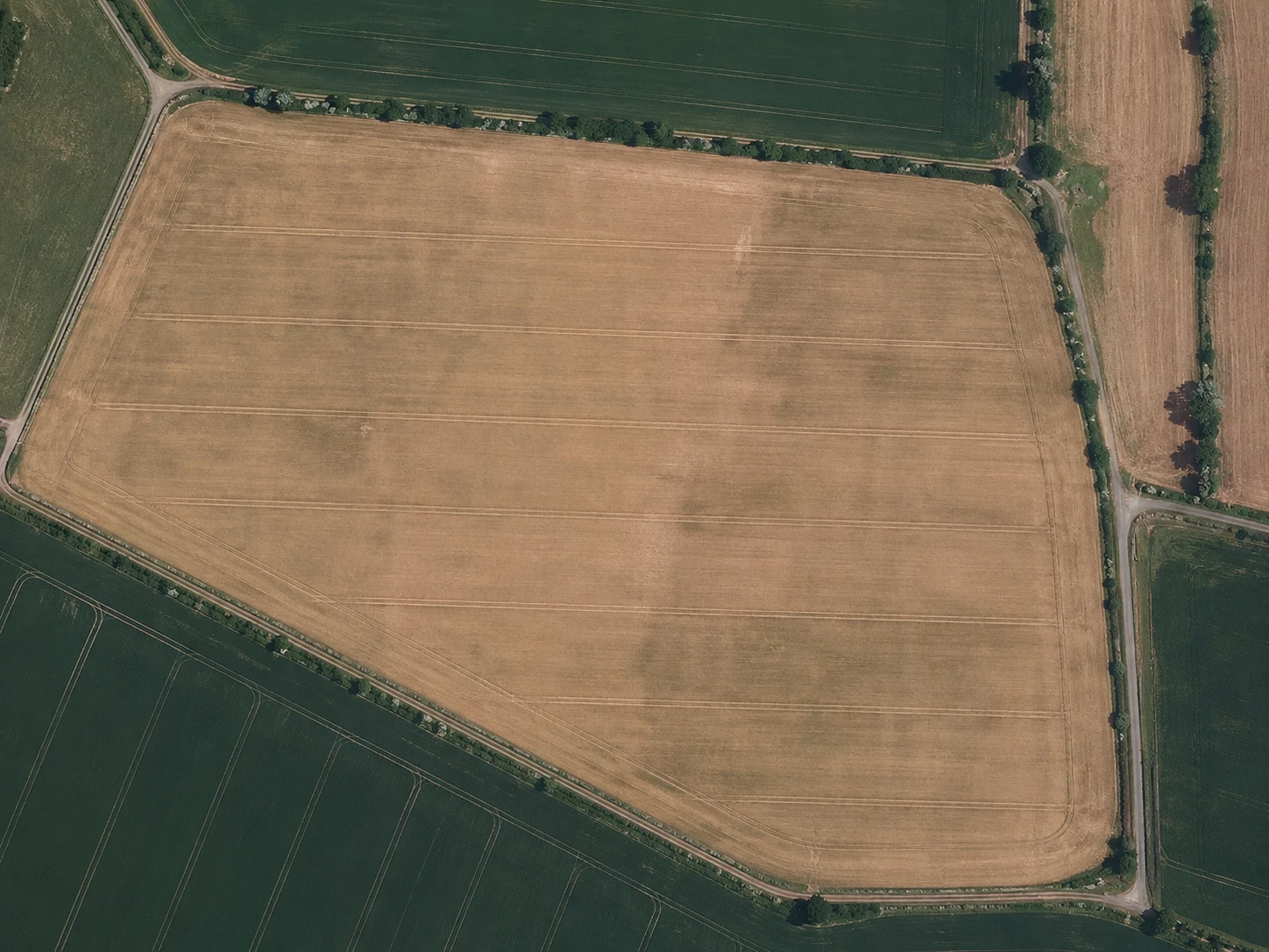
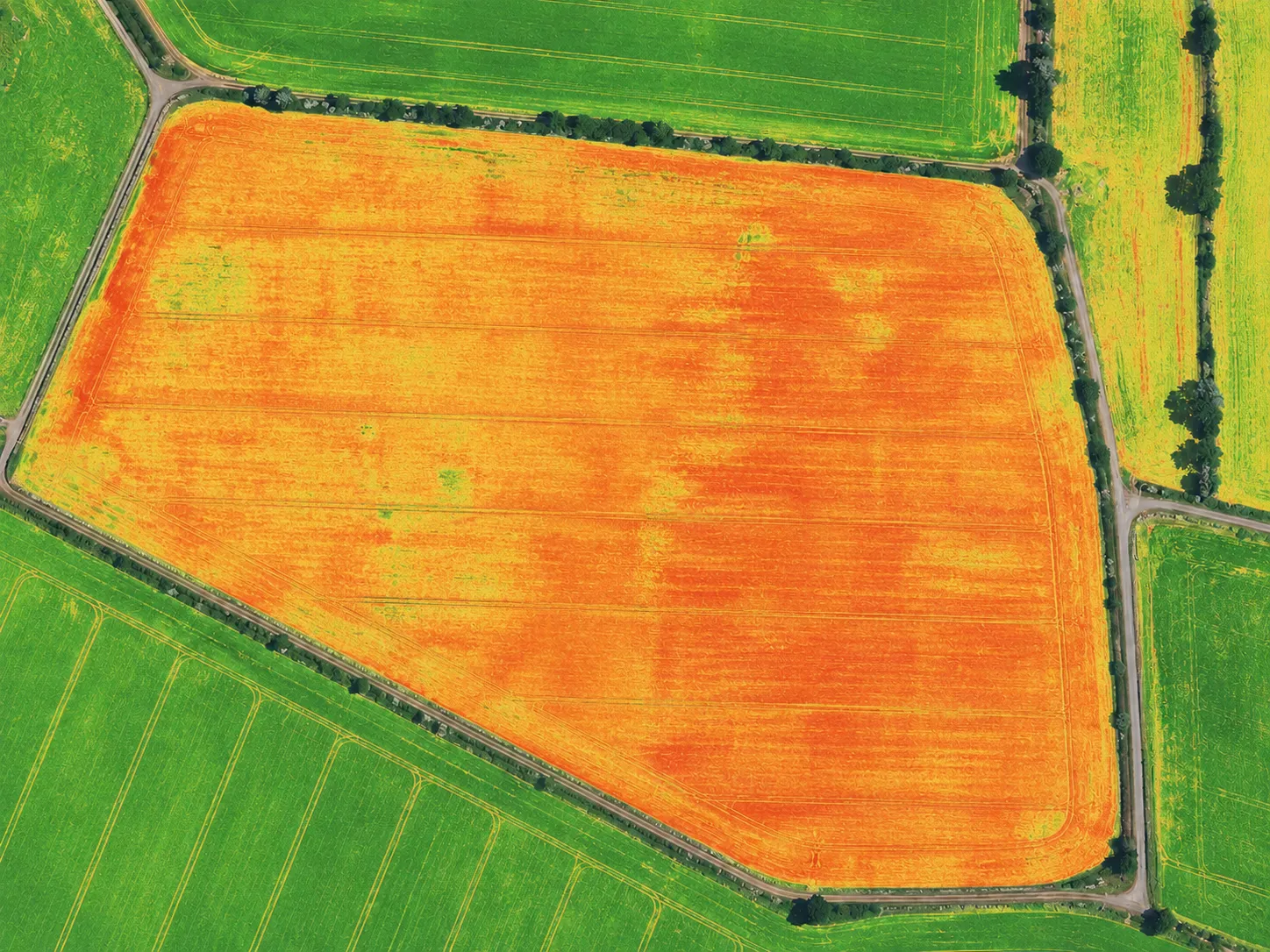
Satellite view of a rapeseed field with machinery tracks, compared against vegetation index layers
PhotoNDVIDrag to compare

Agricultural monitoring platform

Every field, every machine,one screen.

Fresh imagery every 3–5 days with NDVI and moisture layers, offline scouting, machinery tracks, and a work plan that reschedules around the weather.

The platform

One field. Every layer.

Everything Planva knows about a field, stacked on a single map — not five tools that never agree.

Request a demo
0102030405

We bring together satellites, agronomy, and artificial intelligence, so every decision in the field is driven by data, not guesswork.

Pretty numbers are easy.
Your fields are the proof.

Planva is in early access, onboarding a limited set of farms. So instead of hectare counters, here are three promises you can check in a 30-minute demo.

Sharper

than scouting from the field edge

AI reads every pixel of every image, with indices and thresholds tuned to each crop and region, not one formula for the whole country.

Faster

than driving the farm

The moment a new image arrives, problem zones are already highlighted. You learn about crop stress before it can be seen from the road.

Deeper

than any farm archive

Planva rebuilds five years of field history from the satellite archive for migrated boundaries.

Put Planva next to whatever you use today, and let the season show the difference.

Request a demo

MeetPlanva AI

An AI teammate that reads every field, satellite image, weather shift, machine, and operation, then returns with a clear next move.

  • Built for local agronomy
  • Every field in one context
  • Turns insight into fieldwork
Planva AIFarm fields in context

Message Planva AI like a teammate

Give it the outcome in plain language. The prompts and field values below are illustrative, not customer results.

While your team sleeps, Planva AI keeps watch.

When new imagery, weather, or machinery data arrives, Planva AI checks it against open work. It ranks weak signals into alerts with the affected hectares, likely cause, and next move.

Field context
Synced
Monitoring
Active

When the evidence is incomplete, it asks.

Planva AI does not disguise missing context as confidence. It shows what is unclear, asks one useful question, and waits for the agronomist before anything consequential changes.

Planva AI

I found two fields called “North”. Which one should I inspect?

Give Planva AI a job

Switch roles, explore each illustrative thread, or message it yourself. The values shown are not customer results.

Monitoring synced fields

Scans new imagery, compares field history, and pinpoints the hectares worth inspecting first.

Planva AI
Today · 08:12

What changed overnight?

Field 12 dropped 0.08 NDVI in the north. I isolated 4.8 ha and checked it against the last five seasons.

Field 12 evidence.pdfNDVI · NDMI · field history

Why Planva

Your data stays under your control

Choose in-country hosting or deploy Planva on your own servers. Field boundaries, imagery, and observation history stay in the environment you choose.

Terms that fit your organization

We agree deployment, billing, and procurement requirements with your team before onboarding starts.

  • Quote before you sign
  • Procurement support
  • No hidden fees

Support from real agronomists

Planva AI watches the fields, while support questions are answered by people who know crop rotation. We’ll migrate your fields and tailor the platform to your farm.

Can we fit peas into this season’s rotation?

Planva agronomist

Peak-season replies typically about 40 minutes

Offline in the field

The mobile app works without a signal: inspections and tasks are saved and sync when the connection returns.

Buying guides

Start with the decision your farm needs to make

These guides cover migration, satellite monitoring, field work, weather, and data control. Each one answers a different buying question.

The Planva team

Who stands behind
your harvest

Not an outsourced call center or a bot. Behind the platform are agronomists, remote sensing engineers, and developers whom you’ll know by name.

Frequently asked questions

No. Migration is included in your contract and handled by our team. We export field boundaries, operation history, crop rotation, and machinery from Cropwise, ExactFarming, or Excel. A straightforward migration typically takes one day and does not interrupt farm operations.

Talk to Planva

See Planva
on your fields

We’ll upload your field boundaries, show what the satellite has seen on them this season, and work out how fast your Cropwise data can move across.

  1. 01An agronomist reads it, not a bot.
  2. 02We answer within one working day.
  3. 03Then the demo. You drive it yourself, no slides.

Free · No commitment · 30 minutes

Request a demo

Whichever suits you. That is where we answer.

Not sure where to start?

What you work in today
Crops

We use your contact only to answer you. No newsletters.